Tuesday, March 20, 2018

Capitol Reef NP

Capitol Reef National Park Utah

As mentioned in the previous posting, there are 5 major national Parks in Southern Utah. Capitol Reef National Park may be the least known one of the group. We knew of it, but weren't planning on stopping by until I happened to talk to a couple our age while hiking at the Emerald Pool in Zion. It was directly on our way to our next stop, half way more or less and we could reserve a site!

Starting off in the late 1930's as a National Monument ( the president has the power to just create those, Congress has to create National Parks) Capitol Reef is a the name associated with a 100 mile long fold in the  earth that left a reef like rock barrier to early pioneers.

Capitol Reef Campsite - next to original orchards and general store from original settlers that sells pies!!
Like Zion, the area was settled in the second half of the 1800's by Mormon farmers and their orchards thrive to this day. We were able to book a site on line using Recreation.Gov and after driving the 150+ miles eastward from Zion, we arrived mid afternoon in time to check in, watch the 15 minute movie (they are all good folks!) setup camp for our 1 night stay and go explore!

The rock layers are dramatic

contrasts abound

many small roads lead back to  canyons where you can proceed on foot

Jeep was nice but not mandatory for access

water carved rock formations are a dominant feature

again , time to look skyward

Capitol Dome rock
After our afternoon trip and setting in for the night (a small herd of Mule Deer were doing the same across the road in the orchard) we anxiously awaited the Season opening of the general store at 8AM! The Park maintenance guy had told me the pies were excellent! I am always in search of good apple pie and at 8AM I was in line to get our pie and a cinnamon roll along with a cup of coffee. BREAKFAST! (my dad wouldn't not have approved, but what's the difference between pie and a Danish?) Most excellent and Cindy and I returned for two more pies and some Salsa. All good stuff. One guy was there and bought 27 pies at once - there is a surcharge after 3 pies!! A perfect way to wrap up our stay!

original building houses general store - just opened for 2018 the morning after we arrived
Apple pie, sourdough bread, salsa - yummy!

til next time, take care

Cooper and CJ


Zion National Park - Utah

Zion National Park -Utah

After leaving Page, Arizona, we headed West through some beautiful landscapes (and a stone chipped  RV windshield) to Springdale, Utah,  home of Watchman Campground in Zion National Park. Zion is a breathtaking rocky canyon carved by the Virgin River in southwest Utah and one of 5 major National Parks in Southern Utah. Approximately 4 million people visit Zion annually to hike its’ numerous trails (one of which- The Narrows, goes up the Virgin River stream bed in normal conditions) from the valley floor to the tops of the various named rock out croppings, an elevation change of 3000 to 4000’ is all around to enjoy and inspire. We arrived at the South entrance late in the afternoon, after swinging by Safelite Autoglass in St George to have the chip repaired, and using our Senior Lifetime National Parks pass, moved into site A3 in Watchman Campground for the next 5 days.  Setting up camp, putting out chairs, grill, dog bed (bought for Cooper, claimed by CJ) and we were ready to relax and take in the view.

Watchman Campground, ZNP - electric only. 
like Yosemite NP, Zion is very vertical!!
the main canyon goes back for miles!
Our first full day was filled by driving to the far end of the park and hiking The Riverwalk trail, 2.2 miles along the Virgin river. Beautiful. (Btw, we could drive out there as this was the last day the park shuttles were not running). The temps were in the low 40’s which made for great hiking. Then we hopped in the Jeep and drove to Zion Lodge to check it out and buy a snack.

the Virgin River did the carving of this canyon!
We planned to incorporate the drive to nearby Bryce Canyon National Park in our Zion stay, and this was the day to fit it in. (Bryce was forecasted to receive snow starting Sunday!) The drive took us out Zion-Mount Carmel Highway, Utah Rt 9, up the canyon walls on a cut into the hillside and through a mile long tunnel and through some more beautiful scenery.

dusting of snow brings out the  checkerboard pattern on rock face
lots of interesting red rock formations to behold!
The trip over Rt 9 to Rt 89 to Rt 12 took us through varied landscapes , any number of which we would be happy to call home. 90 miles later we were checking in at BCNP and beginning the 15+ mile drive to Rainbow Point at 9115 ft!

get ready for what is just behind the trees!
Again, as you gain elevation, you change environments and once again , as we had first experienced down in Texas at Big Bend NP, we went from brush to full conifer and deciduous forests. This time in several inches of snow. The road was in great condition and we parked the Jeep, cracked the windows for Cooper and CJ and walked 50 yards to be amazed!!!

this arch presented a nice photo op

Bryce has thousands of these Hoodoos!


Bryce is breathtaking - plan for 1 day-(2 days if hiking)
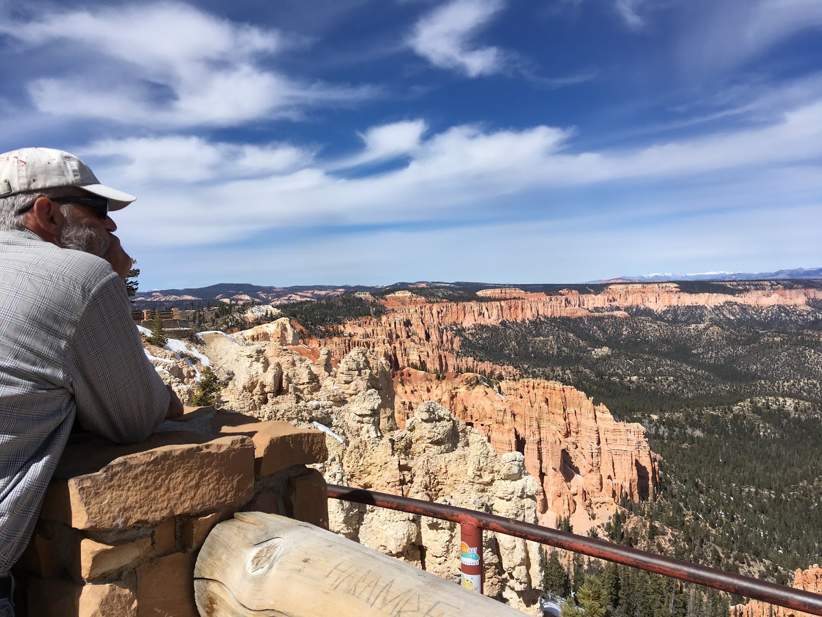
Millions of years of erosion have created a most dramatic landscape of Hoodoos, colors and arches,

harder rock layer on top helps create Hoodoos!
On the way back from Rainbow Point, we pulled in a most of the scenic overlooks and did The short hike at Bryce Point. All views are on the same side of the road, so as you drive out to Rainbow point they are on your left. We hit them on the return to the visitor center- no traffic to cross!

Driving back to camp the same route and stopping for gas at Mount Carmel, saw us arrive just before 5pm and with the  temps in the upper 60’s we again sat outdoors and enjoyed the remaining sunlight before dinner.  Of course, Cooper and CJ got their regular rounds through the campground and even across the bridge to the small cluster of shops and outfitters. I was asked by a young man what kind of dog Cooper is (we get that alot) and then he asked where we were from. I said Pennsylvania and he replied my buddy is from Pa. where in Pa? Lancaster County. He’s from Lancaster County. He steered me over to one of the Outfitter Shops, went in got his buddy, who graduated from Manheim Township H S. Again a small world.

We heard from Cindy’s neice Candy, that they had arrived at their hotel at the edge of the park and we  would be seeing them late in the day Saturday after the hiking was done.

Saturday was again a sunny day. Starting out shortly after 8am, we walked over and caught the park shuttle (first day of operation for the new year) out to The Grotto. There we begain our 3 miles of hiking to the Zion Lodge and Emerald Pool. All of the trails in Zion are sans pets save one, so Cooper and CJ got to chill out during our outings.  We would save the pet friendly Pa'rus trail for later on.

small waterfall at Lower Emerald Pool
We kept taking the  easier hikes, including the Weeping Rock. Rode there on the  free Park Shuttle, toke the short hike. to where the  rock appears to be weeping due to the moistures seeping down through the layers hits a denser layer and forces the water out.

Weeping Rock - water seeping year round, a short hike form the  shuttle
On the way back to the campground, we hopped off the shuttle at the Park Museum and viewed the 15 minute movie on the Park. We try to see all the movies at the parks as they have all been extremely well done and informative. Zion was relatively well know by man for some time, with the earlier native peoples , then Piute's, then Mormons taking turns farming the area. Zion became nationally know in the early 1900s after an artist painted the canyon and displayed his works at a big art show back East. People couldn't believe such a place actually existed and started visiting Zion to see for themselves. National Park status came shortly afterwards.

There is a small commercial area springing up just outside the Park entrance and only a few hundred yards form the campground. Here you can get all the gear needed for your hiking adventures, a Latte, basic groceries, take showers and do the laundry. There is also a Brew Pub!

Great place to be on a beautiful day!
All good things must come to an end and we had one more item on our list. To take CJ on the  1.5 mile dog friendly Pa'rus Trail. Cindy drove out to the far end and dropped us off (she surprised us later near the beginning along with Cooper). CJ and I had our water, a must in the dessert! and off we went!

Pa'rus trail goes through the valley beside Virgin River
Cindy and Cooper met us along the way!

some things can't be improved upon


Our stay here at Zion NP was terrific and offered plenty of sights and hiking of all levels to be enjoyed. A stay here off season such as we experienced was tremendous as we did not have to experience waiting for anything and yet the weather was most enjoyable in the  60's and low 70's and plenty of sunshine! A 5 day stay would be nice, a four day stay OK and you can still fit in a visit to Bryce Canyon NP during that time. 

There are more National Parks to come but til then take care!

Cooper and CJ


Thursday, March 15, 2018

Antelope Canyon and Horseshoe Bend

Antelope Canyon - Page Arizona

Moving from Cave Creek to our next scheduled stop was going to be a bit of a stretch for a one day drive (we try to keep it at 300 miles or less, much more enjoyable).  In this case, there were just a few options in the part of the country we were headed into. Our discussion with one of the camp hosts at CCRP, suggested Page, Arizona, just below the Utah state line and directly on our way to our next stop. He mentioned some canyons to visit and I remembered my cousin Casey and his wife suggesting Antelope Canyon. We checked it out and were able to book a tour for the morning we would be there. All tours must be done through the Navajo Nation as the canyon is on Tribal lands. After making sure all items were properly stored away and everything was unplugged, tanks emptied. and fuel and propane tanks were filled, we headed over the few miles to I70 North and Flagstaff. It is amazing how things change as you drive through a region. leaving the dessert behind and climbing a mile over the course of 150 lineal miles, we were once again driving past snowy woods with large fir and Ponderosa Pines. and then, dropping 2500 feet or more. As we continued on towards Page we were back in the scrub and cactus of the dessert.

just south of Page AZ, back to the dessert
A brief pull over at an abandoned Navajo crafts stand afforded us a nice level site to park the rig, walk the dogs and eat lunch. We were still a few miles to our destination for the night, an RV park in Page. We were only going to be able to stay until late morning the following day to keep our schedule to move on to our next stop. We passed a US National Monument Marker just as we were in sight of the town and made a mental note to check into that after we were checked in and setup for the night. It was mid afternoon and time to call it a day. Checking in, Cindy grabbed our laundry baskets and headed for the laundry and I checked with the office about the national Monument Marker. Turns out it was Horseshoe Bend.  (no not the one near Altoona PA) Only 10 minutes away it is a great sight and its FREE!!!

Horseshoe Bend - back a short hike from the parking lot. 270 degree bend of the Colorado River
Great experience and quite popular, even at this time of the year, people kept coming and going. Taking many, many pictures and taking in its' scenery. The whole experience took just an hour and a half from our campground to there and back, including a 10 minute walk each way. Time well spent! (by the way, because there is a hill between the parking lot and the river, the walk is up hill both ways!)

The next morning, we needed to arrive at our tour office by 7:30 AM for the  8AM tour to Antelope Canyon. Discovered by accident in 1931 by a Navajo girl who could not find her flock of sheep, this is something you want to see if you get in the area. All tours are through the Navajo Tribe and there are several tour companies running trucks out there. The round trip, which includes walking the 1/4 mile through the canyon with your guide takes less than 2 hours. We were informed that due to the narrowness of the canyon, no back packs, walking sticks, selfie sticks are permitted. We had no option but the first time slot, but noon is better lighting. Either way, it is unbelievable!!!

canyon entrance

eroded sandstone

this is early morning light - much better at noon

imagine the little girls parents listening to her explain what she found

exit just around the corner

they call this the dragons eye - do you see it?

you ride out in the back of these trucks on bench seats

Again, we keep being amazed at the beauty and diversity of this great country. We pull into a State or National Park and say "this is amazing"!! The pictures don't do it justice. Come and see for yourself if you haven't done so already!!


more to come in a few days

Take Care

Cooper and CJ


Cave Creek Regional Park

Cave Creek Arizona

Our original plans to spend a week at the Grand Canyon South Rim were thwarted by nightime temps in the single digits. In a RV that means winterizing the plumbing and running the gas furnace full time. That coupled with limits on activities available, steered us to cancel our site and seek warmer temps within a reasonable drive to our next planned area.This turned out to be back in the Phoenix area at Cave Creek Regional Park. Cave Creek is one of several Regional Parks run by Maricopa County. It offers electric and water, nice bath houses, goergeous desert views , hiking trails and horse back riding. Being we were coming in at their peak season...snow birds and Spring Training Baseball followers, we felt extremely fortunate to get 5 out of 6 nights at regular sites and one in the overflow area (dry camping- no hook ups).

typical campsite at Cave Creek Regional Park - lots of space and great views

moon rise from our RV

one of many specie of cactus - Compass Cactus turns towns the sun

Saguaro - found only in the Sonoran Dessert. Holes are birds nests
Temps were perfect, the park staff friendly and the locale advantageous. We hiked, did maintenance, read books in the sunshine and rode horses.

it had been a while, but we managed to stay on for the entire ride!

a dozen of these drifted by as we were packing up to depart Cave Creek
One of the great things about camping is talking with others. The vast majority want to share their travel favorites and readily offer tips for things to see and places to visit (and occasionally things to avoid). We log this info into our trip list or if it is in the immediate area, go check it out. In other cases, to be revealed in the next post, we picked up on those travelling to our next site down the road!

hope you enjoyed and take care

Cooper and CJ


Wednesday, February 28, 2018

Sedona Arizona

Sedona - Red Rocks

After leaving Apache Junction and LDSP, we had a 3 hour drive up I 17 to Sedona, Arizona.
For those of you not familiar with this area, it is the land of breathtaking red rock formations, numerous hiking and biking trails and art galleries. For some it is also an area of, dare I say, cosmic forces through several vortec sites. For the film buffs - many western movies were filmed here up until the early 1970's. The drive in is on a beautiful road, which was thoughtfully upgraded a few years back, Arizona 179. Everything in the area harmonizes with the red rocks, which dominate views in all directions for miles around. The 9 intersections coming into town utilize traffic circles instead to lights to enhance the flow - nicely landscaped and traffic moves along nicely.

one of 9 traffic circles coming n from I17 - Bell Rock in background

this is what greets you as you approach Sedona!!!
The directions had us take the  first exit out of the 9th traffic circle and a few hundred yards later, we were pulling into our home for the next 10 days -Rancho Sedona RV Park.

located just across Oak Canyon Creek form the heart of town, Rancho Sedona RV Park
Snoopy Rock as seen from in front of our RV
After setting up the rig for a week plus stay, there was still a few hours left to go explore the area.

A little something for everyone - check out the sign on the left side
We stopped by the Visitors Info Center, got the scoop and the free visitors map and off we went - first stop Fay Canyon Trail Head and a nice 2 mile hike.

Fay Canyon west of town -fantastic rock formations 

very inspiring - yes the sky is that blue!
The next day, we decided to visit the "ghost town" of Jerome. A former open pit copper mine set on a extremely steep hill side west of Sedona, it has become a strong tourist draw. Half way there, our plans were changed by a passing car throwing a stone which produced a dime sized chip very low and in the center of the Jeep's windshield. Hello Safe Lite Auto Glass!!! A smart phone lookup, a quick call and we were routed to their Prescott location. We arrived for our appointment, were inspected and informed it was indeed repairable and it would take about half an hour. We took Cooper and CJ for a little leg stretching, returned, sat for 10 minutes and....our Jeep was fixed! We were back on our way. Since we were now in Prescott, Cindy looked up our notes for what to do while there. My sister and her family had visited a few years back and highly recommended we check out the Palace Saloon. This is the very same saloon where Wyatt Earp and Doc Holliday hung out prior to moving down to Tombstone. Though the  building was rebuilt after a fire in 1900, they had saved the actual bar from the flames!

always good to read these things

Cindy getting ready to check it out

Marker's Mark, not Red Eye
We then continued checking out the historic section of the town and decided after purchasing a Native American Bedspread, that we could still fit in Jerome, our original destination. I thought, hey, why go back out to the 4 lane, let's take Arizona 89A which runs from Prescott, through Jerome and back to Sedona??? So we did and it was a very, very interesting drive, winding up through the mountains, very steep, very narrow, very curvy with some tremendous views. My sister had mentioned if we go there probably don't want to take the RV - that's for sure!! But way cool and glad we did it. We arrived in Jerome, parked and headed out to explore a town that at one time had 15000 residents, several car dealerships, a high school,  the works. Then the mine was closed in the early 1950's  and the population dropped to approx. fifty with it rebounding a bit with the town turning into an art colony in the 1970's. It hangs on the side of the mountain!!!

open pit portion of mine at Jerome

mine ambulance that ran on the ore car tracks underground

Jerome Street - met a Lancaster County friend here!
While checking out the town, Cindy sat on a bench with Cooper and CJ while I went into a small museum. When I returned, she was talking with a mutual friend of ours from Lancaster County whom we both had worked with - Kim Hatch!! small world!!!!!

The drive down the rest of the mountain was just as adventurous, but in 10 minutes we were in the valley and cruising back to the RV for the evening.

The next day was another hike , this time from the Sedona Airport vista down to the Sedona Vortex near the edge of town. We took Cooper and CJ  made the .6 mile hike down to and then up the  vortex and enjoyed the view and experience. CJ and I did the uphill return to the Jeep while Cindy and Cooper took in more of the view.

the 3 C's on the vortex

vortex from Airport trail. notice people on top
After getting back to the Jeep and picking up Cindy and Cooper, we went to the hardware store to pickup dog food and then to The Coffee Pot for our own food. (another great suggestion from Sis) They offer 101 omelets!! Really yummy.

The Coffee Pot Restaurant - nice place
The next day was rainy and cold, good time to do those chores, laundry, go to the library and grab some hi speed internet, etc. Walk dogs, is always on the list.

The sky cleared again and we resumed our hikes around the area checking out the area south of town - Bell Rock, Cathedral Rock, Rabbit Ears and more. Many of these trails have minimal elevation changes and are shorter distances, making them a very nice way to enjoy the sights, get some  exercise, but not over do it. There was also a solo hike from about a mile past our campsite back into town that CJ and I did on Sunday afternoon.

Watching the weather at all time, some days colder that others, we zeroed in on Monday to drive 2 hours north to the Grand Canyon. We originally had a weeks reservation there, but with  lows in the single digits, we opted out and decided to do just a day trip. No river rafting this trip! We once again got to use our lifetime National Parks Senior pass!!! This thing cost us $10 and has saved us hundreds of dollars in admission and campsite fees. It got us into Grand Canyon for free!

great experience - put it on your list
We drove to the South Rim, checked out what to see for a day's stay with the Rangers and off we went. As we approached the  rim, a wind gust flared and as I grabbed for my hat, my sunglasses (Walmart fitovers) blew out past the railing and landed about two feet from the edge - no way am I going after those! We walked and drove from the visitor center viewing area stopped a numerous view points and got to the end at Hermits Rest. Before we headed out in the Jeep, I went back to try to lasso my sunglasses with the dog leash and some kind soul had somehow retrieved them and left them at the railing!!! Many thanks!!

These sights cannot be captured in pictures. We took dozens and offer a few here to give you an impression, but... you should see it for your self.

all views are spectacular

hundreds of miles in length

hiking trails to the bottom

the Colorado River is down there!

It was now mid afternoon and time to head back to the RV. There was one more stop to be made while doing so...A side trip into Williams, the last town bypassed by I 40!! (think the Pixar Cars movie) Route 66, Americana from our youth and a good piece of Apple Pie!!

my favorite desert

downtown Williams AZ and the original Route 66

Once more a walk into town, Lunch at the famous Cowboy Club restaurant and then some time at the dog park for Cooper and CJ. CJ was needing some open throttle time and Cooper likes to socialize.

Cowboy Club - many famous western stars ate here


chilli, cornbread and Bison burger - Yummy!!!

great dog park at edge of town
Our Stay in this area has been most rewarding and the sights memorable. We highly recommend you stop by if you can.

sunset on red rocks


time to pack up for the next site

take care

Cooper and CJ